|
Projects |
|
|
Our branch collaborates with partners across the globe from government agencies, private and commercial industry, and academia to conduct basic and applied research. Research topics include all aspects of the ocean, air-sea interface, waves, ice, coastal zone, rivers, forecasting, assimilation, satellite and in situ observations, numerical modeling, high performance computing, and more! Our results are published in peer reviewed journal articles and are transitioned to prediction systems that are operationally used by the U.S. Navy to make immediate and long-term decisions.
Explore the links below to find out more information on a few of the ongoing projects.
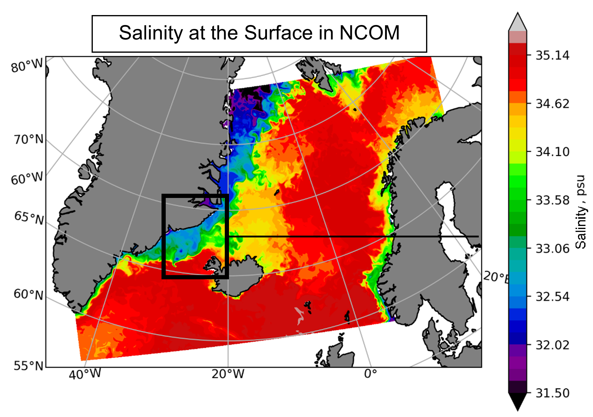
HighLatModel
Modeling high Latitude Ocean Dynamics
|
Understanding the ocean dynamics causing the source of deep-water formation in the North Atlantic and Arctic Oceans to shift southward.
|
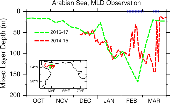
MixingIntermit
Winter-mixing Intermittency and Restratification
|
The project aims to identify and isolate the relative role of submesoscale eddies on the generation of mixed layer intermittency during winter, and the extent to which atmospheric forcing modulates it.
|
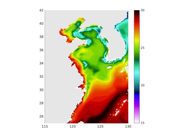
ECSYSUpwelling
Upwelling in the East China Sea and Yellow Sea
|
Understand how upwelling in the East China Sea and Yellow Sea (ECSYS) is dynamically controlled or modified by tides.
|
GlobalOcean
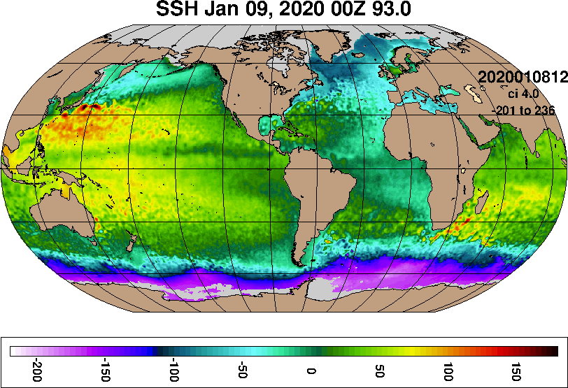
Global Ocean Forecast System (GOFS)
|
An operational global ocean/sea ice nowcasting and forecasting system that runs daily by Fleet Numerical Meteorology and Oceanography Center.
|
Mixing
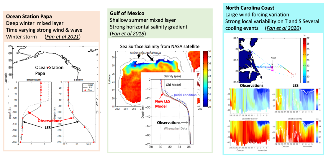
Improved Mixed Layer Depth and Upper Ocean Structures via Turbulent Mixing Advancements
|
Develop and incorporate a unified upper ocean mixing parameterization into the Navy’s operational ocean models by building on new theories and improving on the shortcomings of each.
|
VLFs
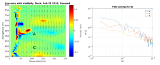
Generation of Very Low-Frequency
Oscillations in the Nearshore
|
Understand and analyze the generation mechanisms for very low-frequency oscillations (VLFs) arising from the mutual dynamic wave-current interaction in surf zones.
|
PSIPS
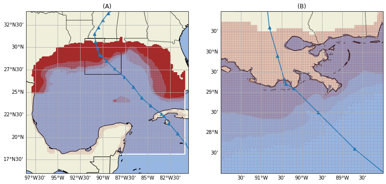
Probabalistic Surge and Inundation Prediction System Ensemble Modeling (PSIPS)
|
The probabilistic surge and inundation prediction system (PSIPS) estimates water elevation, maximum water elevation, and likelihoods of exceeding water thresholds resulting from landfall of a tropical cyclone.
|
ALTIM
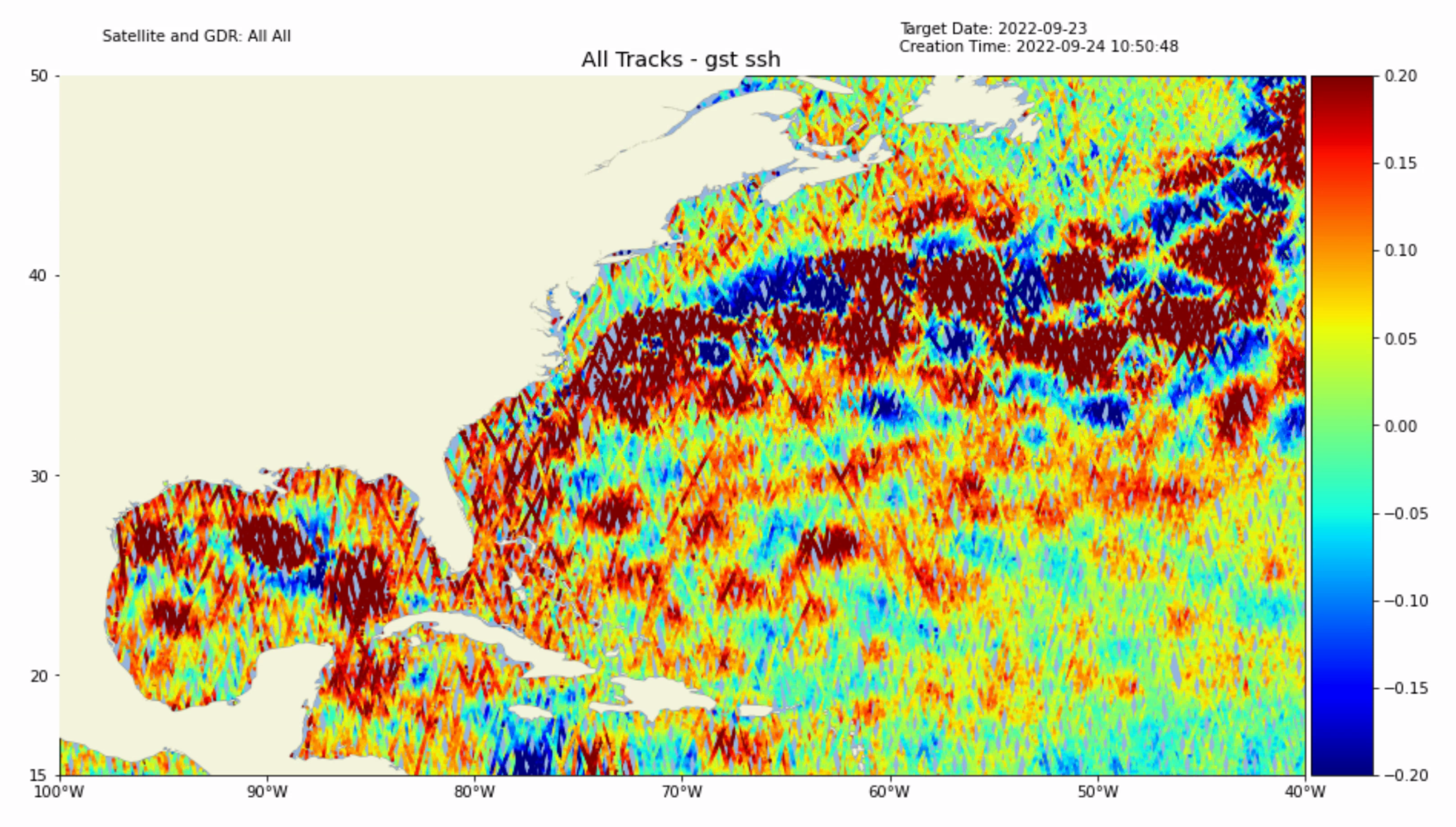
Altimeter Processing for Ocean Prediction
|
Satellite observation of sea surface height is our key to knowing the internal ocean heat structure.
|
SeaIce
Sea Ice Prediction
|
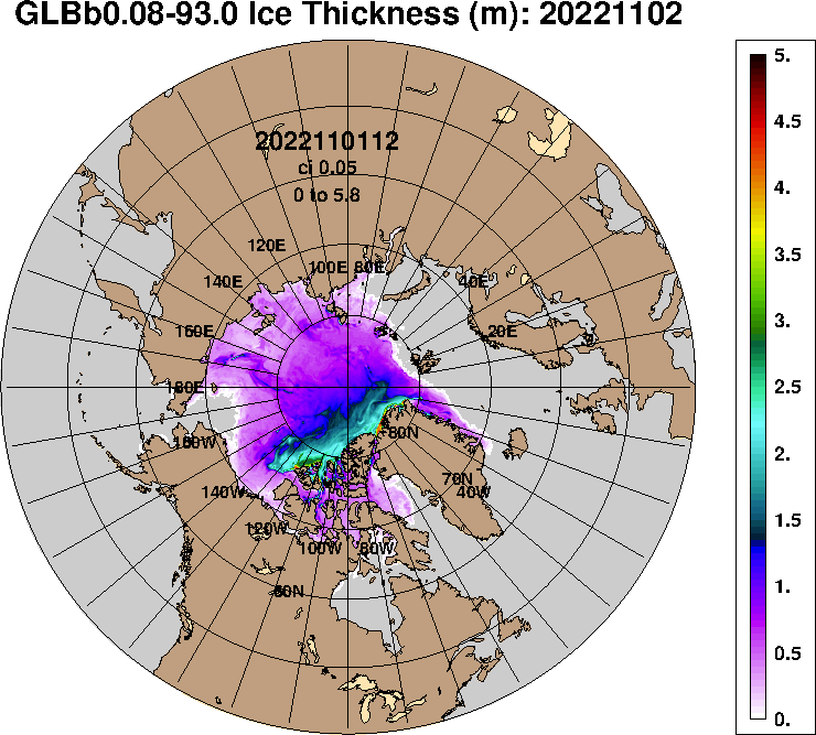
NRL-developed sea ice prediction systems support Navy operations near and through the ice. This includes deterministic (out to 15 days) and ensemble (out to 45 days) prediction systems.
|
SubmesoEddy
Submesoscale Eddy Lifecycles
|
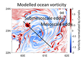
Research study to gain a fundamental understanding of ocean submesoscale eddy lifecycle progression and the associated impacts on the surrounding ocean environment.
|
WaveAssim
Assimilation of Spectral Wave Data
|
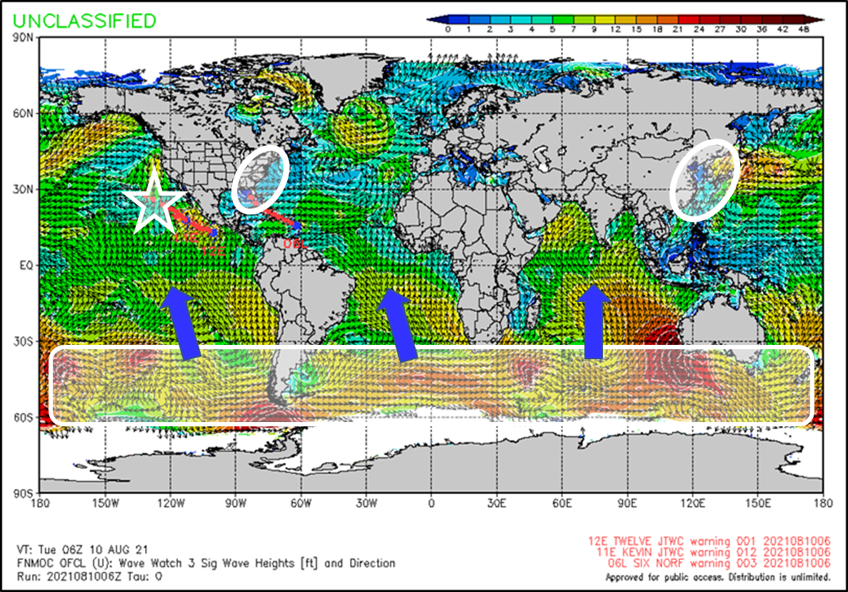
A system to import measured ocean surface wave data into the model WAVEWATCH III®, significantly improving wave forecasts for the deployed fleet.
|
Global HYCOM
1/12° Global HYbrid Coordinate Ocean Model (HYCOM)

|
Results from the 1/12° Global HYbrid Coordinate Ocean Model (HYCOM),
including snapshots, animations and forecast verification statistics, mainly sea surface height (SSH),
sea surface temperature (SST), surface currents and subsurface temperature and salinity.
It also contains direct model-data comparisons.
|
| |
