Office of Naval ResearchNaval Research Laboratory |
|---|

ITOP
Impact of Typhoon on the Pacific
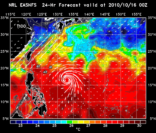
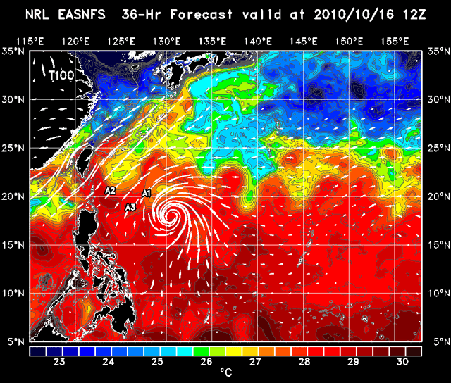
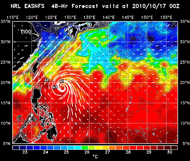
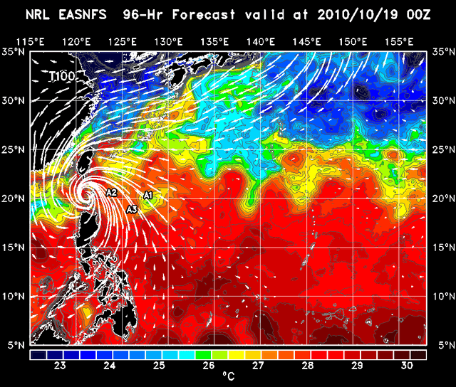
NRL EASNFS Ocean Prediction

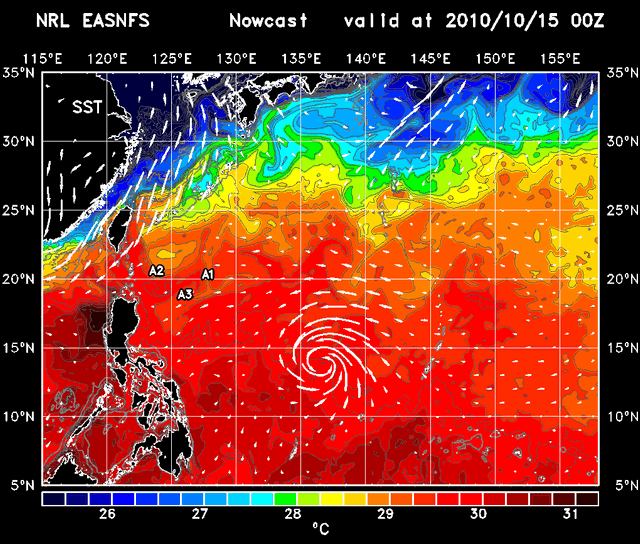
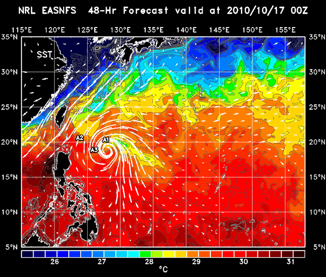
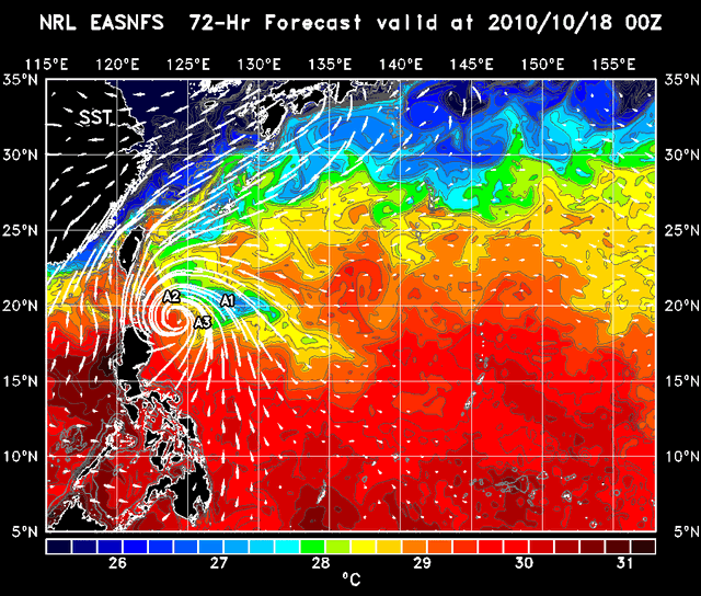
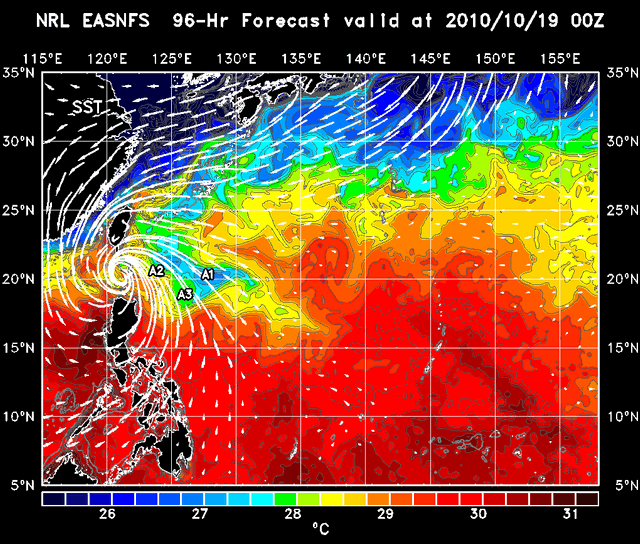
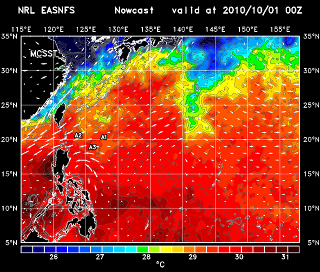
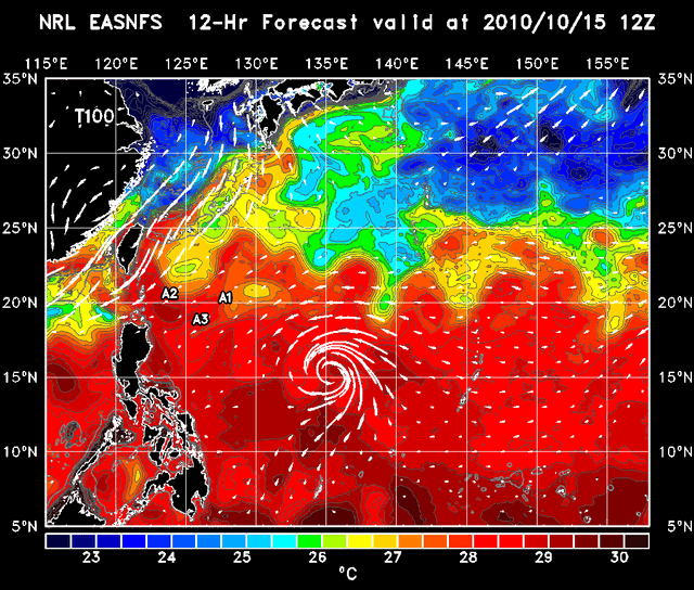
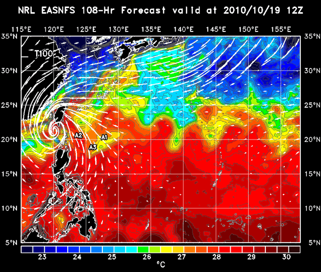
| SST
Sea Surface Temperature
|
 |
Nowcast
00 | 12 |
|---|---|---|
| MCSST
Multi-Channel Sea Surface Temperature
|
 | Analysis
00 |
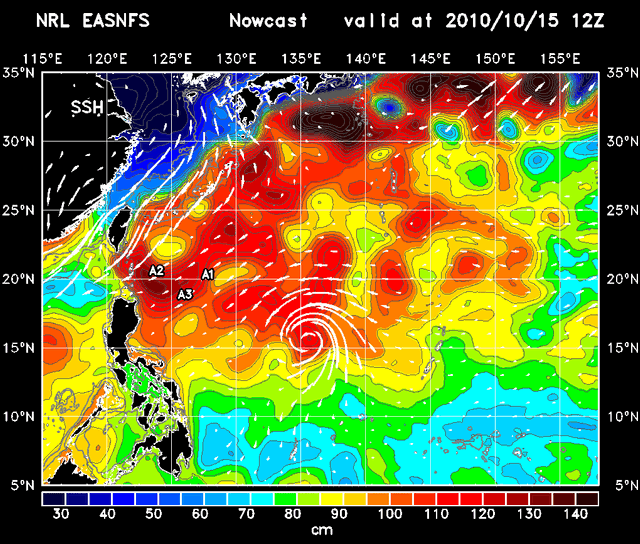
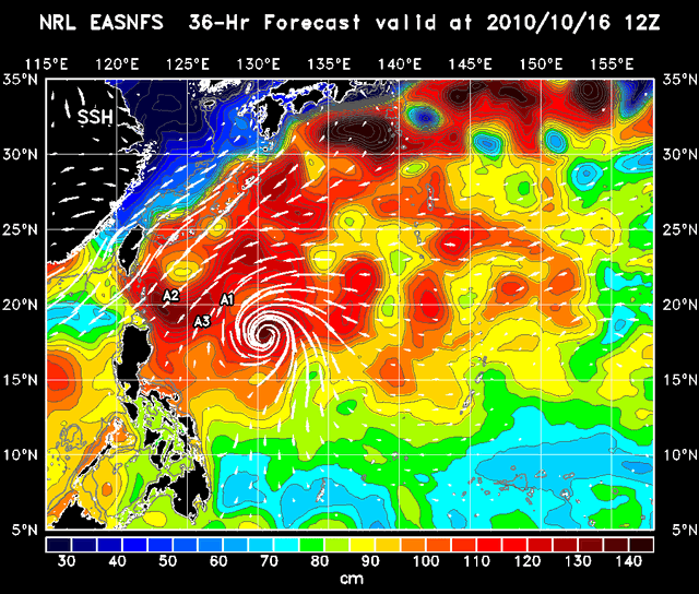
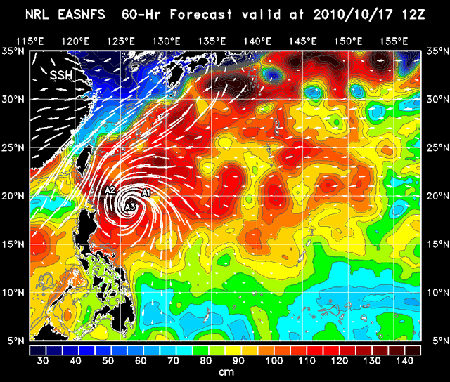
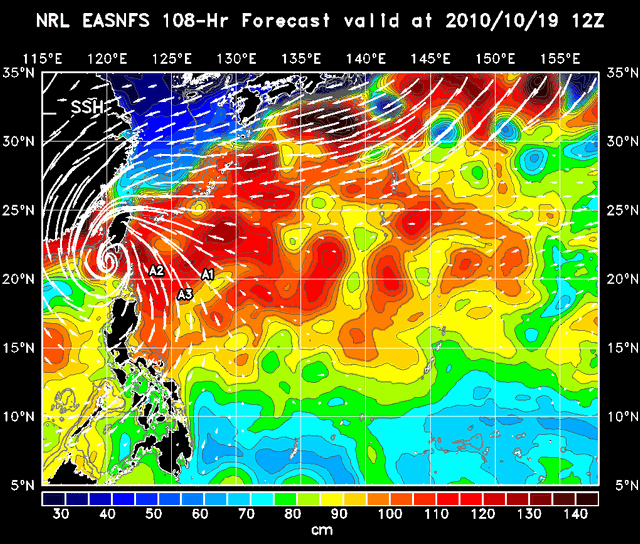
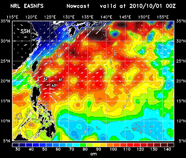
| SSH
Sea Surface Elevation
|
 | Nowcast
00 | 12 |
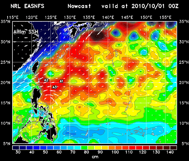
| Altimeter SSH
Altimeter Sea Surface Height
|
 | Analysis
00 |
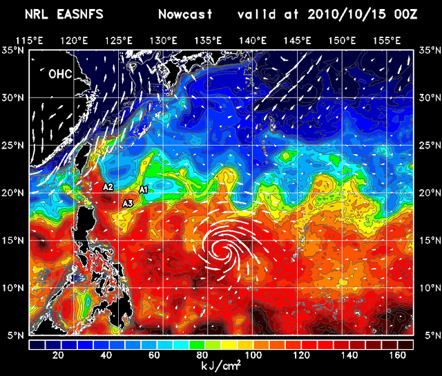
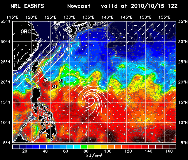
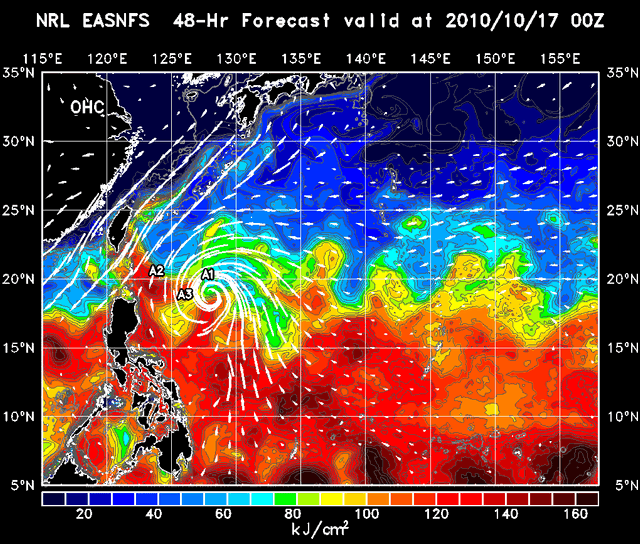
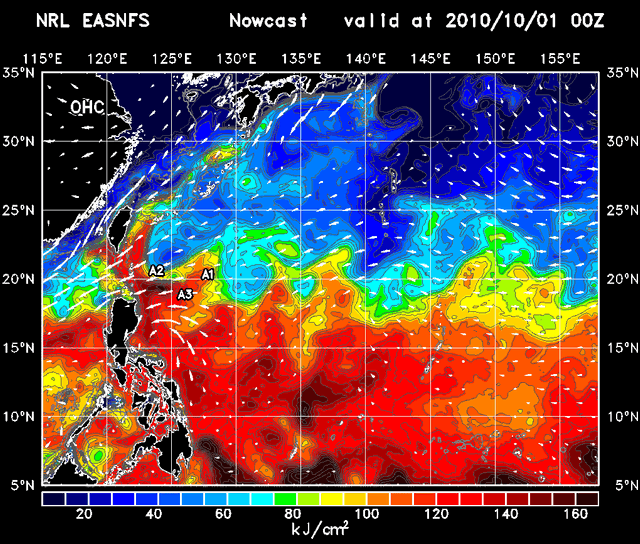
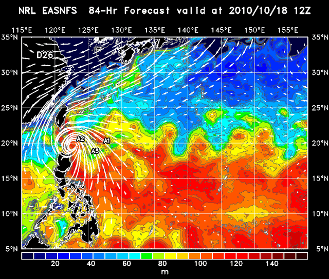
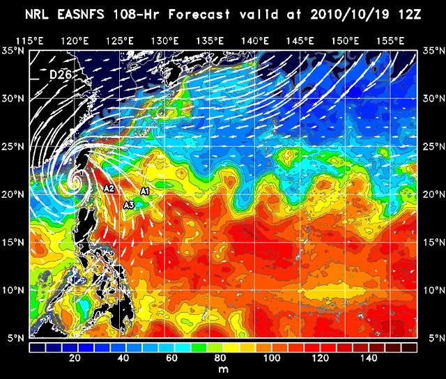
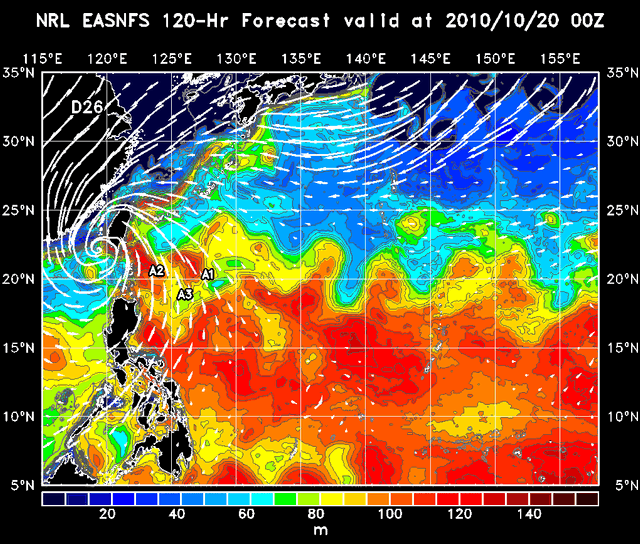
| OHC
Ocean Heat Content
|
 | Nowcast
00 | 12 |
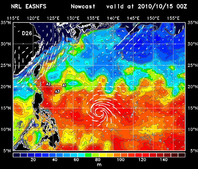
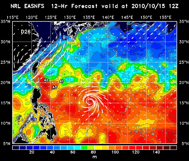
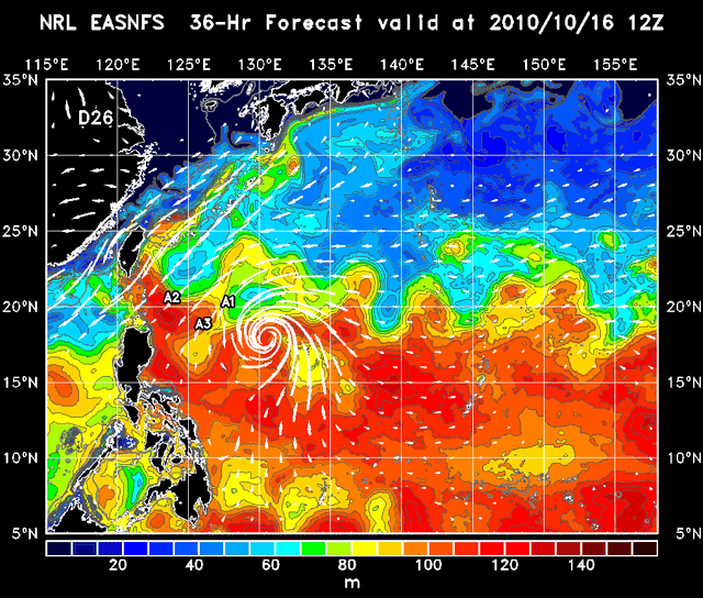
| D26
Depth at 26C
|
 | Nowcast
00 | 12 |
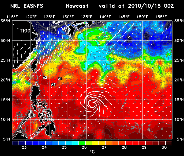
| T100
100 m Averaged Temperature
|
 | Nowcast
00 | 12 |
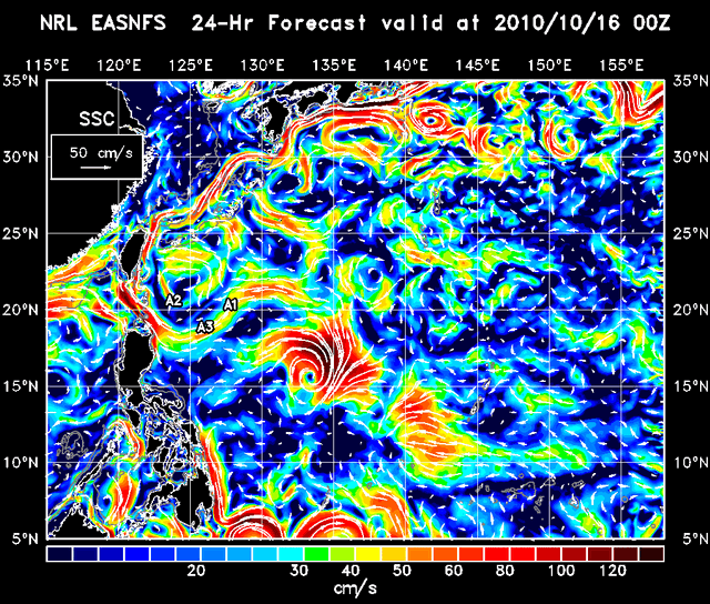
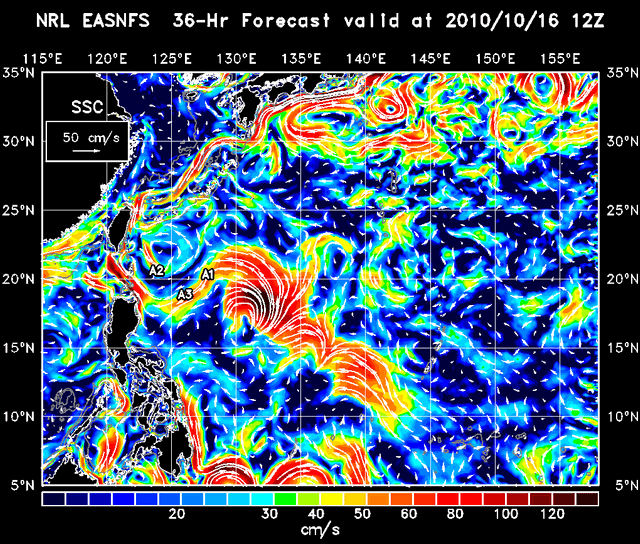
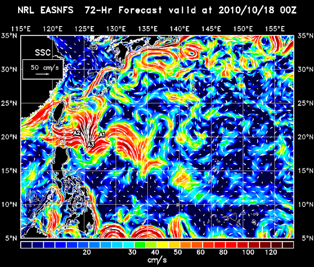
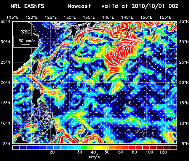
| SSC
Sea Surface Current |
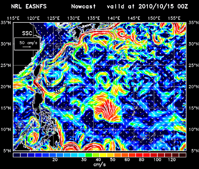 | Nowcast
00 | 12 |
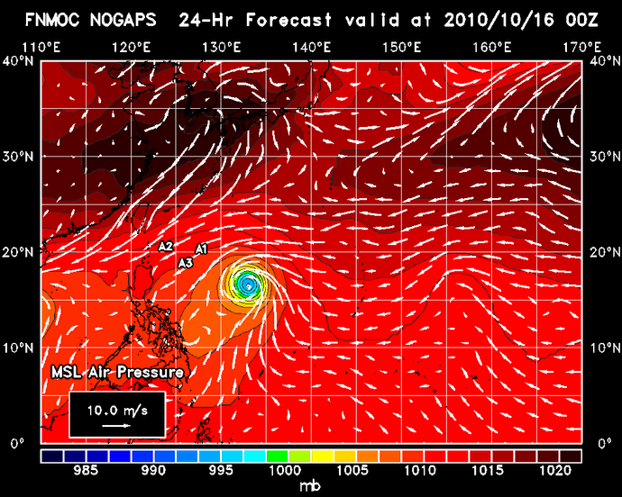
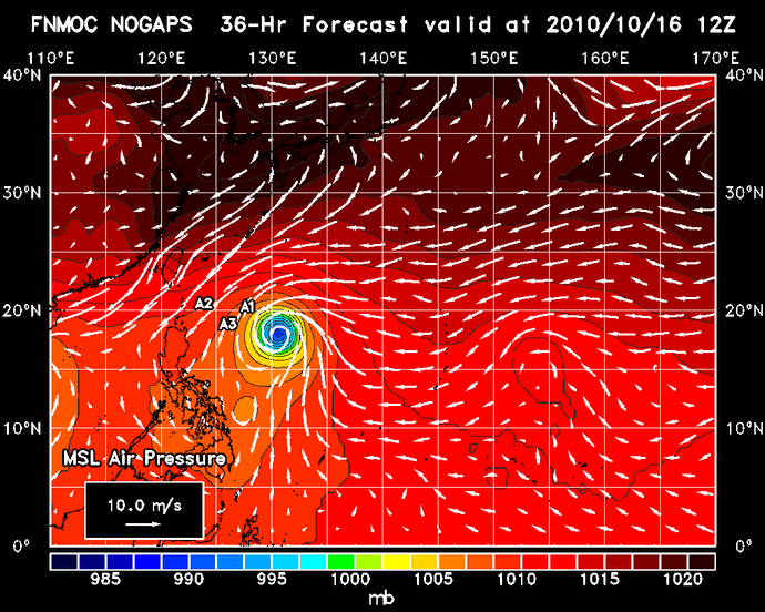
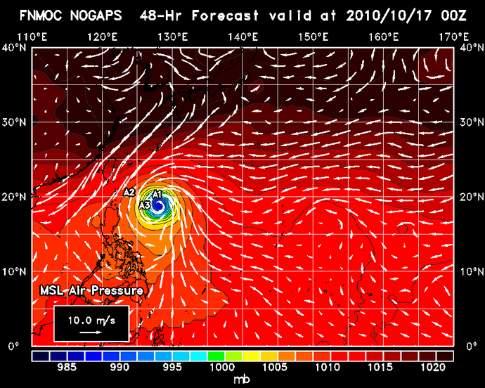
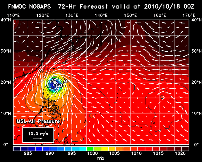
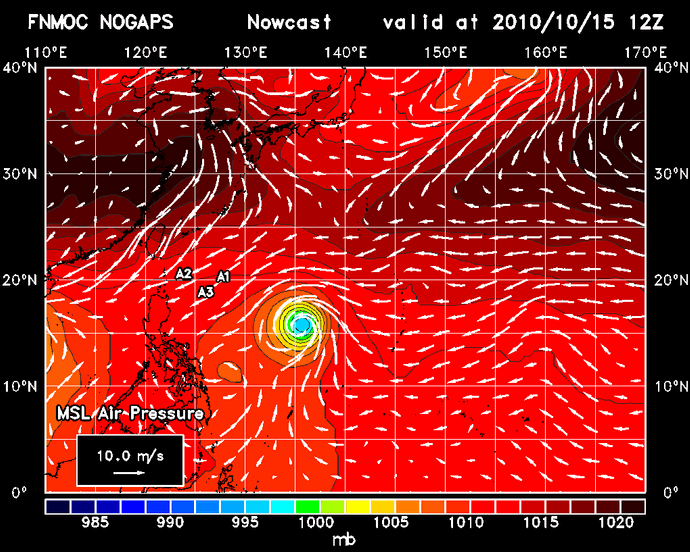
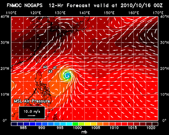
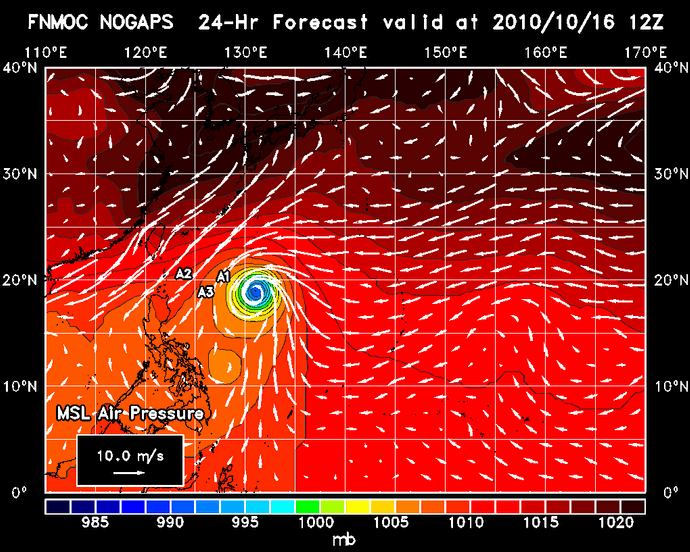
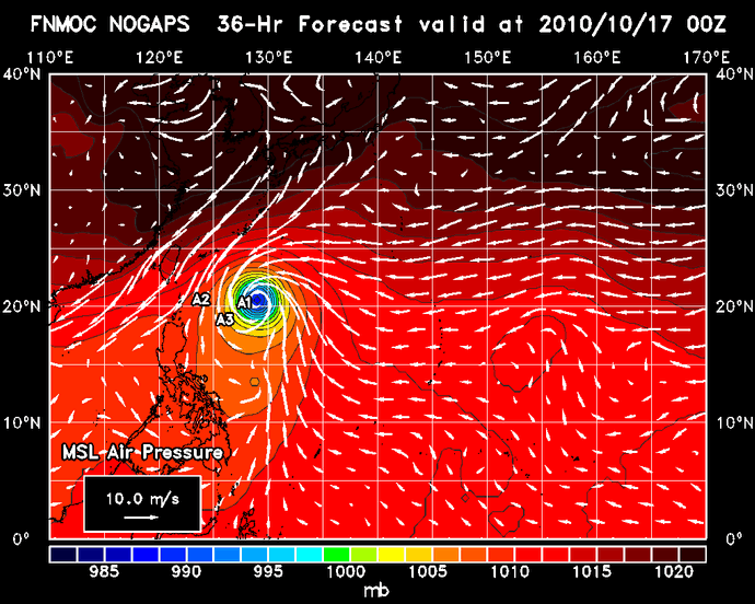
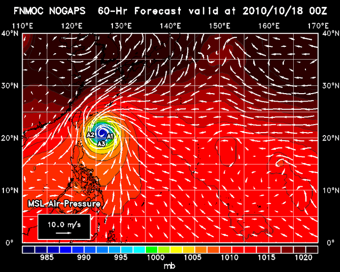
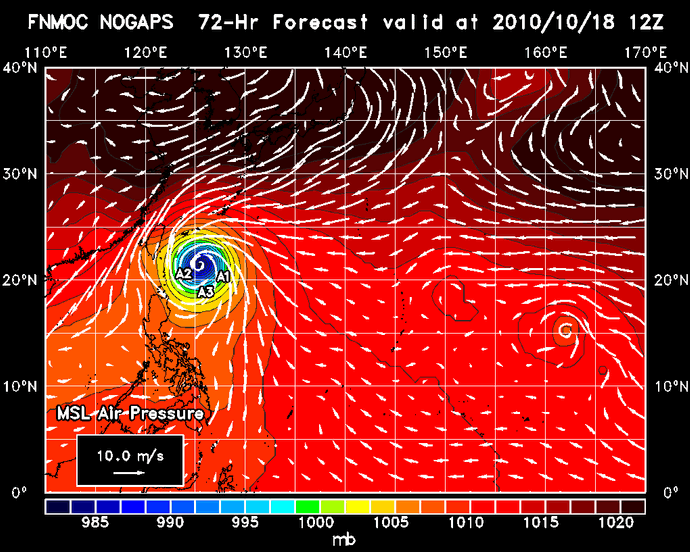
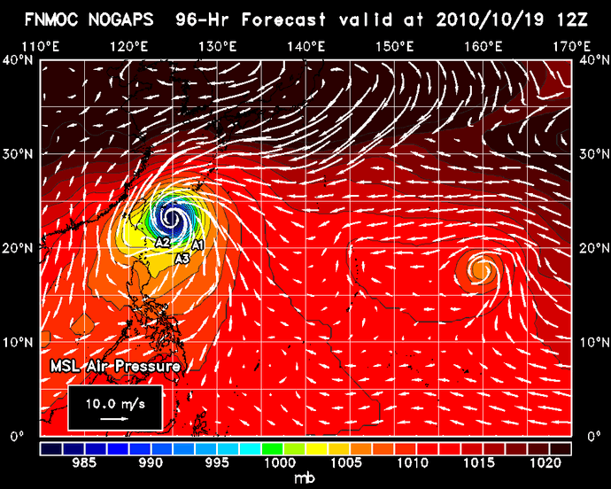
| NOGAPS
Sea Level Air Pressure
|
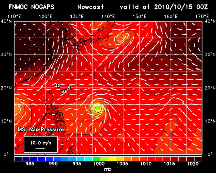 |
Nowcast
00Z Forecast 12 | 24 | 36 | 48 60 | 72 | 84 | 96 108 | 120 Nowcast
|
|---|---|---|
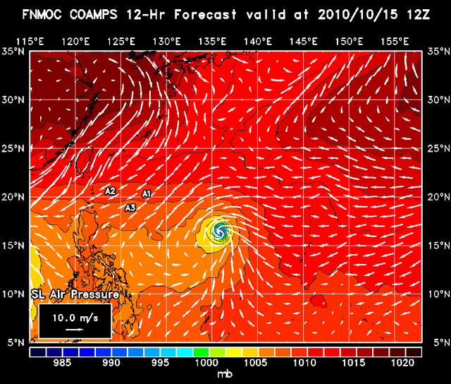
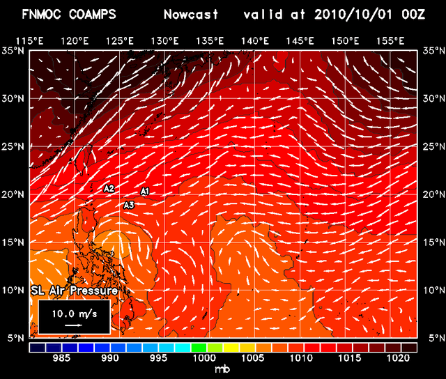
| COAMPS
(West Pacific) Sea Level Air Pressure
|
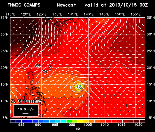 | Nowcast
00Z Forecast 12 | 24 | 36 | 48 |
Archive: 2009 2010 | Download Data | EASNFS References | ITOP Home
EASNFS: NRL Eastern Asian Seas Nowcast/Forecast System