EASNFS
East Asian Seas Nowcast/Forecast System
![]()
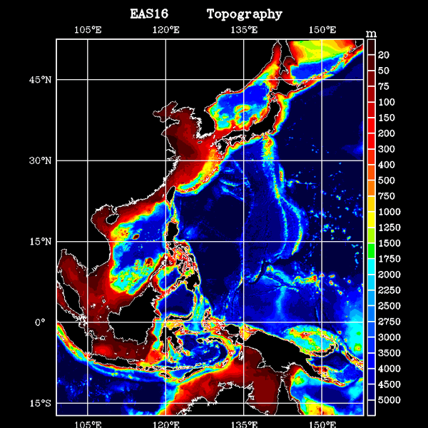
model domain & topography
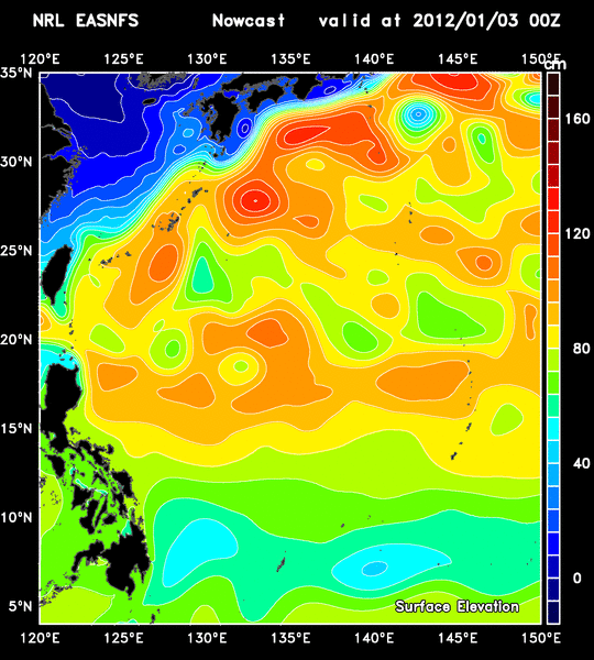
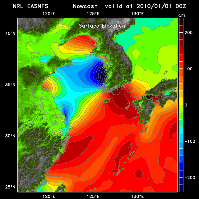
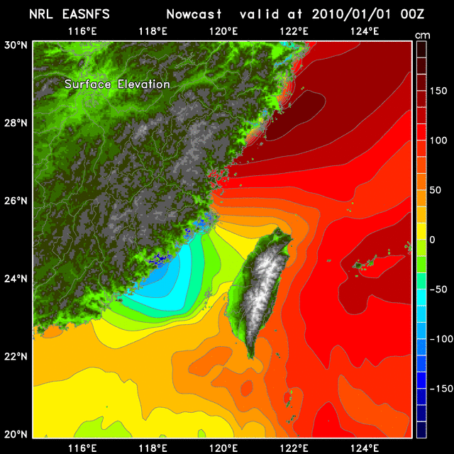
| EASNFS is an Ocean Nowcast/Forecast System for the East Asian Seas used for real-time prediction at NRL to support observations and for a wild variety of studies such as for ITOP and NLIWI. The area of EASNFS coverage is from 17.3S to 52.2N and from 99.2E to 158.2E. It includes all the Asian Marginal Seas - from South China Sea, East China Sea, Yellow Sea to Sea of Japan. The system produces prediction for the sea level variation, 3D ocean current, temperature and salinity daily. |
|---|
| EASNFS consists an ~1/16 degree, 41-level sigma-z data-assimilating ocean model based on NCOM (Navy Coastal Ocean Model). The horizontal resolution ranges from 9.8 km at Equator to ~6.5 km at model northern boundary. The model topography is from 2-min NRL DBDB2 bathymetry data base and improved with available high resolution bathymetry and sounding data. There are 142 rivers or fresh water runoff points with monthly discharges in the EASNFS. |
| The system is initialized at 1997/12/01 from temperature/salinity analyses based on satellite altimeter SSH and MCSST and climatology. Once model is initialized it continuously assimilates the synthetic temperature/salinity profiles generated by a data analysis model called MODAS to produce reanalysis. A vertical weighting function and scale seperation scheme are applied for the data assimilation. Satellite altimeter (GFO, Jason-1, ERS-2, EnviSat, TOPEX etc.) sea surface height anomaly and AVHRR sea surface temperature (MCSST) are used. |
| Three hourly wind stresses, sea level air pressure, heat fluxes, solar radiation, and percipitation/evaporation from NOGAPS/FNMOC and later from NAVGEM/FNMOC are applied for surface forcing. The open boundary conditions including sea surface elevation, transport, temperature, salinity and currents are provided by the Navy Global NCOM and later by the Navy Global HYCOM. One way coupling scheme is used to ingest those boundary conditions and tides into the EASNFS model. Details in the data assimilation and open boundary conditions can be found in Ko and Wang (2014). |
| An EASNFS realaysis was produced over a 20-year period from 1998 to 2017. It was used to study mainly the typhoon-ocean interaction but also provided open boundary conditions to embbeded high-resolution grids, mostly for internal waves studies in the northern South China Sea. Real-time prediction continues up-to-date. |
| Referances & Applications of EASNFS |
|---|
Chen, C.-C., D.S. Ko, G.-C. Gong, C.-C. Lien, W.-C. Chou, H.-J. Lee, F.-K. Shiah, and Y.-S. W. Huang, 2022: Reoxygenation of the hypoxia in the East China Sea: A ventilation opening for marine life, Front. Mar. Sci. 8, 787808, doi:10.3389/fmars.2021.787808
|
Lee, I-H., T.-Y. Fan, D.S. Ko, and K.-H. Fu, 2018: The temporal variations of daily tempearture in coral reef area of Nanwan Bay, Sci. Rep., 10, 8656, https://doi.org/10.1038/s41598-020-65194-8 |
Ko, D.S., S.-Y. Chao, C.-C. Wu, I-I Lin, and S. Jan, 2016: Impacts of Typhoon Fanapi (2010) on Seas around Taiwan, Terr. Atmos. Ocean. Sci., 27, 261-280,
doi:10.3319/TAO.2015.10.28.01(Oc)
|
Wu, C.-C., W.-T. Tu, I.-F. Pun, I-I Lin, and M.S. Peng, 2016: Tropical cyclone-ocean interaction
in Typhoon Megi (2010). A synergy study based on ITOP observations and atmosphere-ocean coupled model simulations, J. Geophys. Res. Atmos., 121, 153-167, doi:10.1002/2015JD024198
|
Ko, D.S., S.-Y. Chao, C.-C. Wu, and I-I Lin, 2014: Impacts of Typhoon Megi (2010) on the South China Sea, J. Geophys. Res. Oceans, 119, 4474-4489, doi:10.1002/2013JC009785
|
Ko, D.S. and D.-P. Wang, 2014: Intra-Americas Sea Nowcast/Forecast System Ocean Reanalysis to Support Improvement of Oil-Spill Risk Analysis in the Gulf of Mexico by Multi-Model Approach, Departement of the Interior, Bureau of Ocean Energy Management, Herndon, VA. BOEM 2014-1003, pp. 55, http://www.data.boem.gov/PI/PDFImages/ESPIS/5/5447.pdf
|
Lee, I.-H., D.S. Ko, Y.-H. Wang, L. Centurioni, and D.-P. Wang, 2013: The mesoscale eddies and Kuroshio transport in the western North Pacific east of Taiwan from 8-year (2003-2010) model reanalysis, Ocean Dynamics, 63, 1027-1040, doi:10.1007/s10236-013-0643-z
|
Lin, I-I, C. Hu, Y.-H. Li, T.-Y. Ho, T. Fischer, G.T.F. Wong, J. Wu, C.-W. Huang, D.A. Chu, D.S. Ko, and J.-P. Chen, 2011: Fertilisation potential of volcanic dust in the low nutrient low chlorophyll western North Pacific Subtropical Gyre - satellite evidence and laboratory study, Global Biogeochem. Cycles, 25, GB2006, doi:10.1029/2009GB003758
|
Chang, Y.-T., T.Y. Tang, S.-Y. Chao, M.-H. Chang, D.S. Ko, Y.J. Yang, W.-D. Liang, and M.J. McPhaden, 2010: Mooring observations and numerical modeling of thermal structures in the South China Sea, J. Geophys. Res. Oceans, 115, C10022, doi:10.1029/2010JC006293
|
Ko, D.S., S.-Y. Chao, P. Huang, and S.F. Lin, 2009: Anomalous upwelling
in Nan Wan: July 2008, Terr. Atmos. Ocean. Sci., 20, 839-852, doi:10.3319/TAO.2008.11.25.01(Oc)
|
Teague, W.J., D.S. Ko, G.A. Jacobs, H.T. Perkins, J.W. Book, S.R. Smith, K.-I. Chang, M.-S. Suk, K. Kim, S.J. Lyu, and T.Y. Tang, 2006: Currents across the Korea/Tsushima strait: review of LINKS observations, Oceanography, 19, 53-65.
|
Keen, T.R., D.S. Ko, R.L. Slingerl, and S. Riedlinger, 2006: Potential transport pathways of terrigenous material in the Gulf of Papua, Geophys. Res. Lett., 33, L04608, doi:10.1029/2005GL025416
| |
|---|
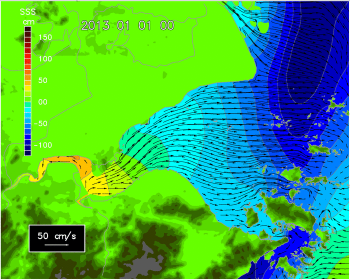
Surface Current from XM to HK: 202505 | wind | 202512 | wind | read_wind |
monthly
Drifter Tracking with wind effect: movie 1 | movie 1c movie 2 | movie 2c
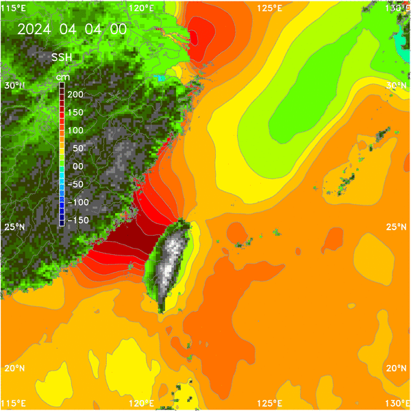
Monthly Reanalyses: SSH | SST | SSS | TWe | TWt | TWs 5day-average ssh: WPac 1998 | 2005 | 2012
Tides: Yellow/East China Sea | Tsientang River | Taiwan Strait | Taiwan
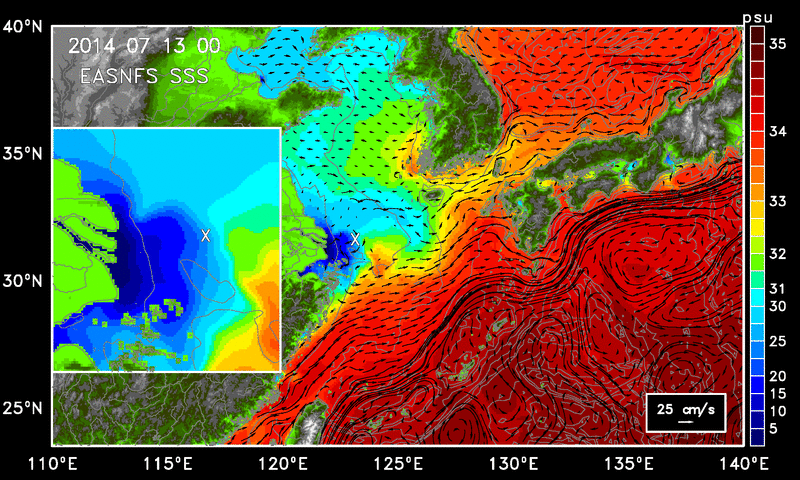
East China Sea (2014): SST | SSS
Transport through Taiwan Strait | Tidal Prediction
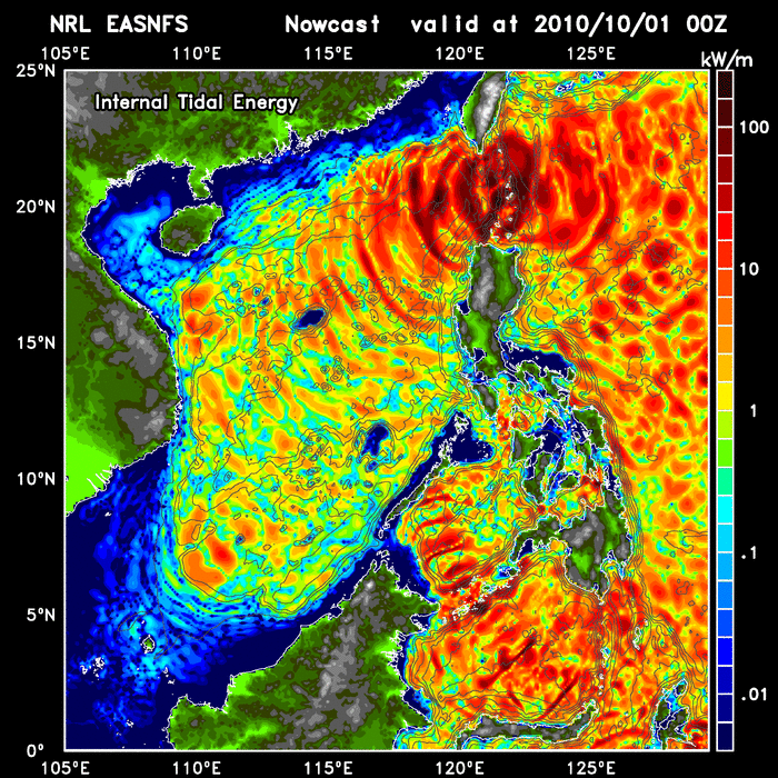
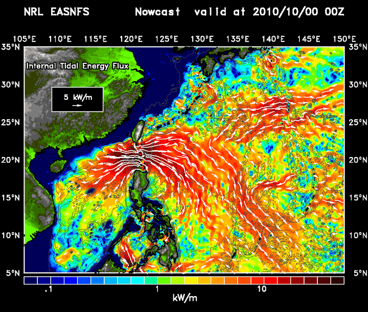
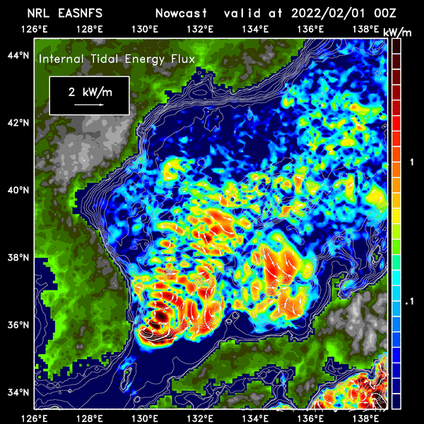
Internal Tidal Energy at South China Sea: movie | Internal Tidal Energy Flux: plot
Internal Tidal Energy at Sea of Japan: movie
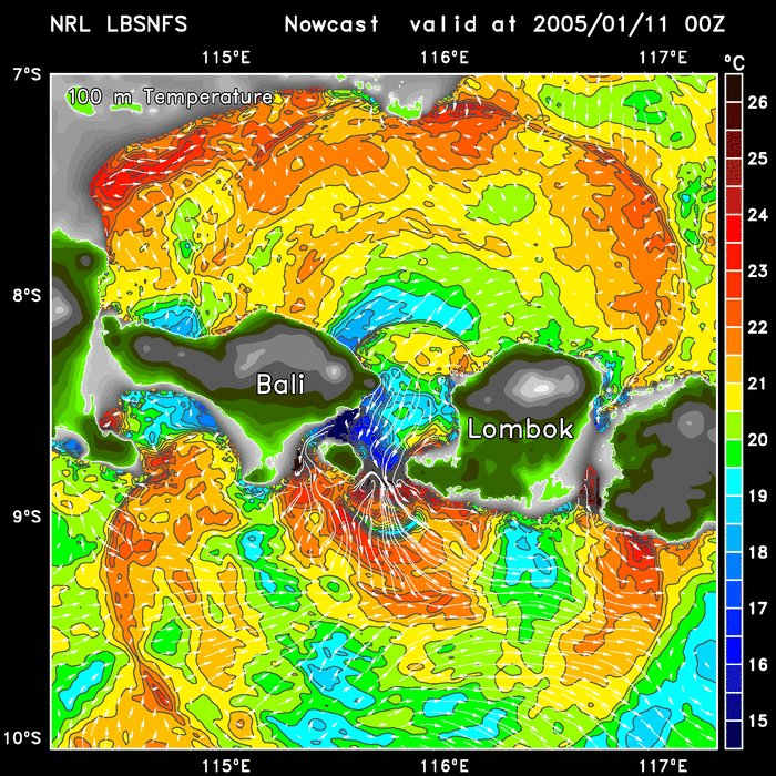
Internal Waves at Lombok Strait from a high-resolution model embeded in EASNFS: movie
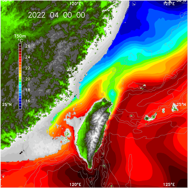
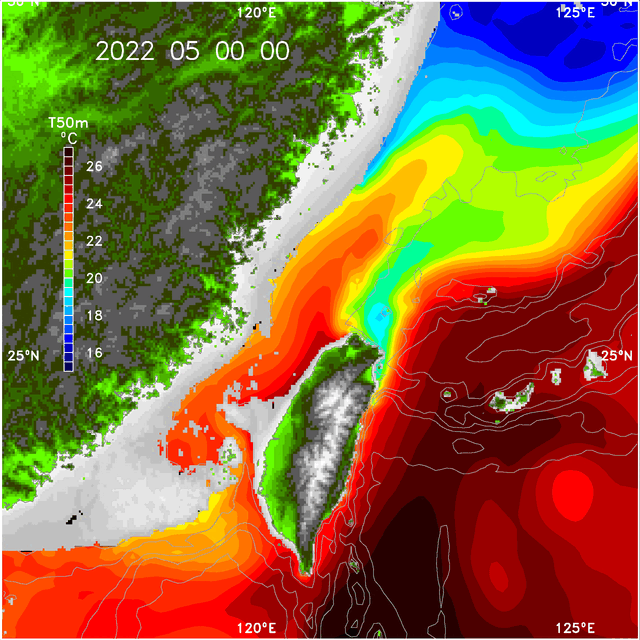
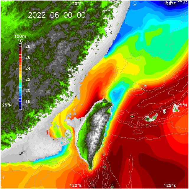
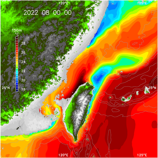
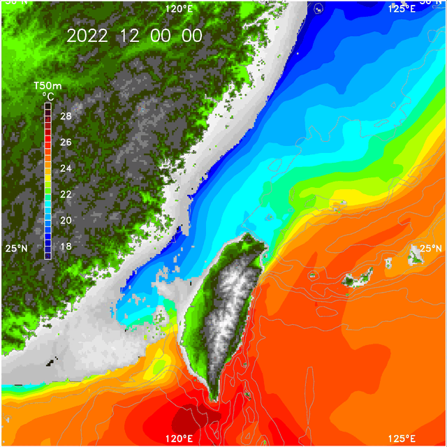
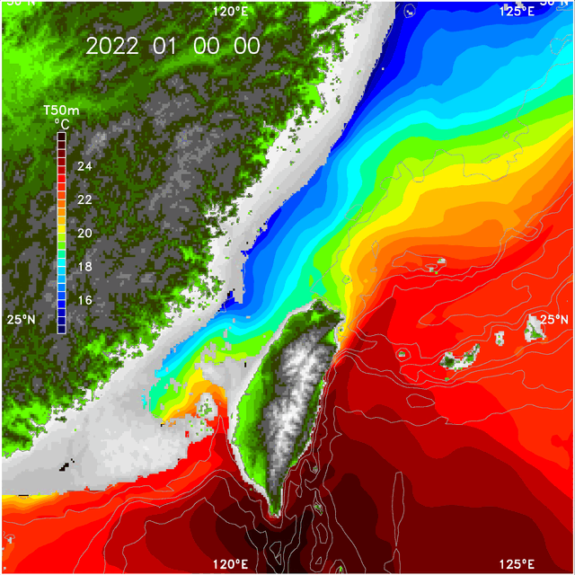
Seasonal T50m 2022: 01 | 02 | 03 | 04 | 05 | 06 | 07 | 08 | 09 | 10 | 11 | 12 | movie
NPAC ssh: with surface current | mean/rms | vs dynamic height
5-day average ssh movie: 2000 | 2001 | 2002 | 2003 | 2004
mean removed: 2000 | 2001 | 2002 | 2003 | 2004
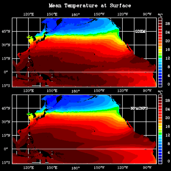
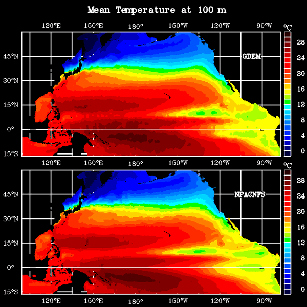
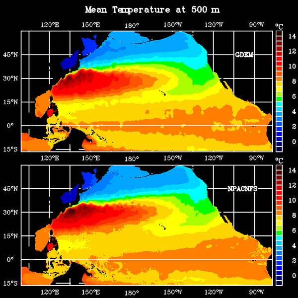
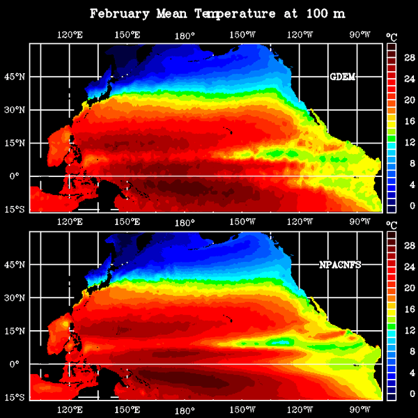
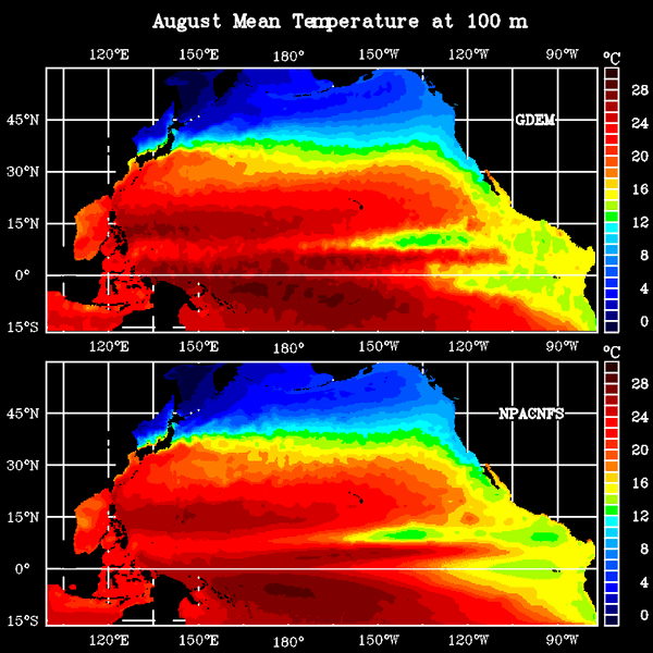
NPAC mean temperature: surface | 100m | 500m | 100m(Feb) | 100m(Aug)